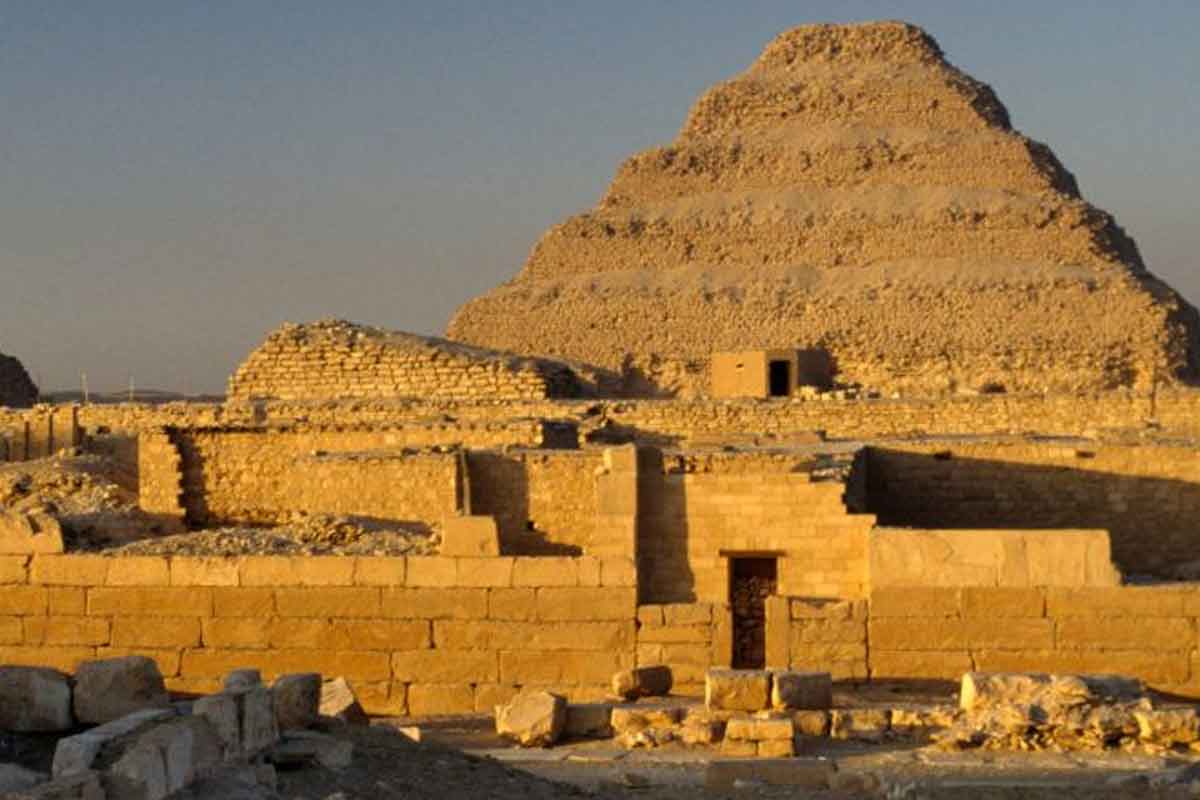
A silent desert hid vast shapes in plain sight, and a fresh way of seeing finally unlocked them. Using Artificial Intelligence, researchers scanned images at a speed no team could match, then checked each hint on the ground. In a short burst of work, they expanded knowledge at a site known for mystery. The find now reshapes how experts map fragile heritage. Proof came through peer review, and the scale of the update shifts the field. The story begins with lines, but it ends with meaning.
Nazca Lines scale, age, and a desert built for symbols
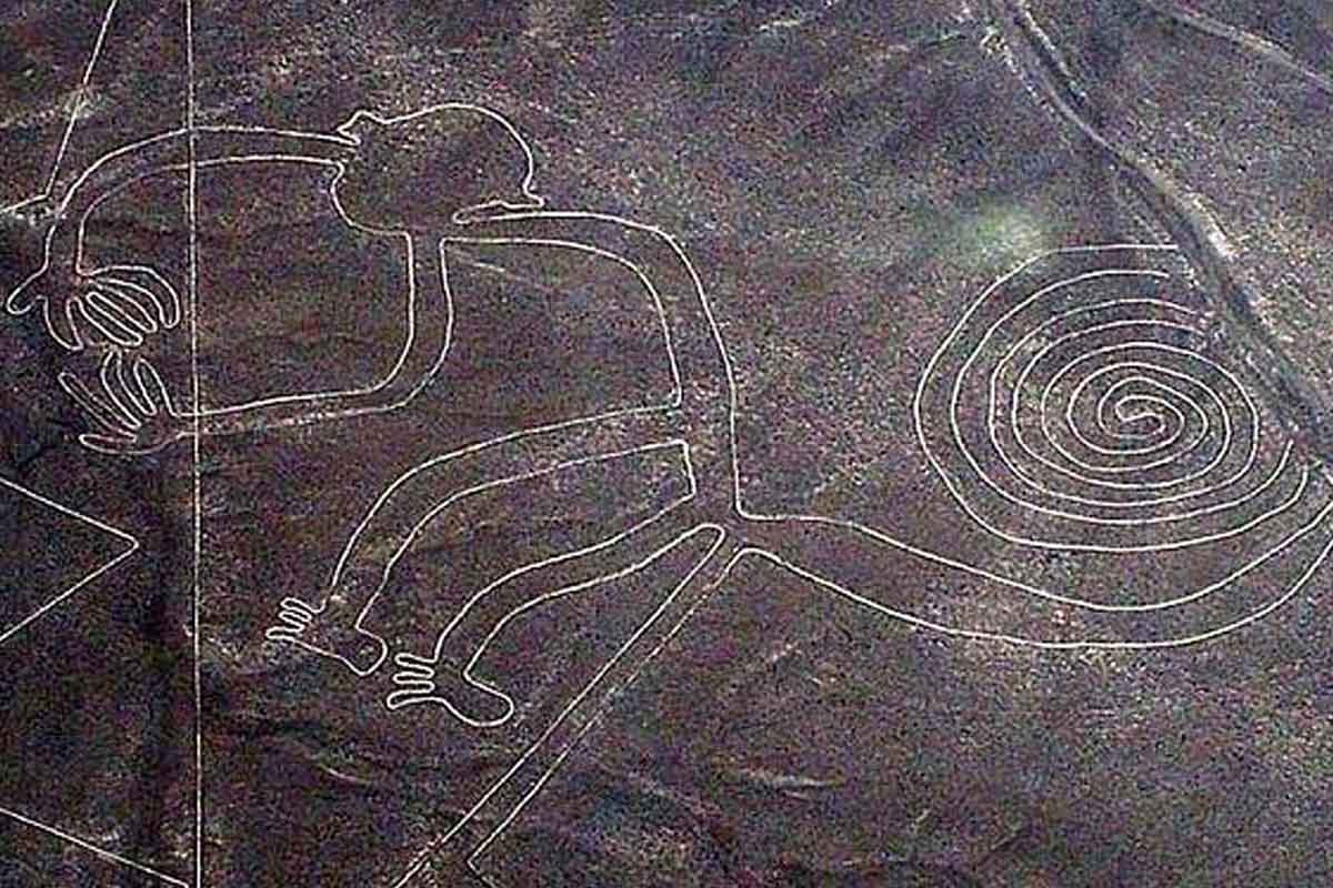
In six months, a joint team from Yamagata University’s Institute of Nazca and IBM doubled the number of known Nazca Lines. The survey revealed 303 previously unknown geoglyphs in Peru’s coastal desert. Proceedings of the National Academy of Sciences (PNAS) published the study, and lead archaeologist Prof. Masato Sakai confirmed the result. The site holds UNESCO World Heritage status because the designs are immense and fragile.
The Nazca people carved these figures between 200 BC and 650 AD. They drew stylized animals, plants, and geometric forms. Some stretch hundreds of meters across. Many shapes maintain crisp symmetry despite their size. The desert kept them, yet distance and erosion made them hard to spot.
Older methods relied on aerial photos, ground walks, and slow mapping. So teams missed faint lines and subtle edges. Vast terrain added to the challenge. Better tools changed that balance, because pattern detection can now scale while field teams protect context.
How Artificial Intelligence changed surveying speed and precision
The joint team trained algorithms on thousands of labeled aerial images. Then the system sifted terabytes of satellite and drone data, because only that volume could expose faint shapes. It flagged candidates with consistent geometry and unusual alignments. Each flag became a field task. Crews checked the spot, logged the soil marks, and recorded GPS points. That loop raised precision and trimmed noise without losing speed.
Prof. Sakai credited the short timeline to AI support, yet the map grew only after verification. Researchers confirmed forms of felines, birds, fish, and abstract figures. Many keep perfect balance from end to end. One workflow filtered glare, another enhanced edges, and a third ranked probability. Artificial Intelligence did not replace craft; it focused attention where faint patterns hid.
The dataset expanded fast because models got better as labels grew. Feedback from each visit improved detection. So the system learned nuance, while teams kept control of context and meaning.
From lines to living pathways across a sacred landscape
Fresh mapping revived an old idea. Many figures likely formed ritual walkways used in processions. People may have walked paths to connect with deities and the landscape. Shapes could also mark viewing points, seasonal cues, or territorial claims. The new layout supports those practical roles, while the art still stuns the eye.
Maria Reiche, the German mathematician who mapped the lines for decades, noted their geometric rigor. The new figures match her observations on orientation and scale. They cluster near routes and ridges, which suits a designed network. The desert, then, acts like a vast stage set for movement and sightlines.
Field checks showed symmetry that holds across long spans. That precision hints at tools for measuring and planning. Artificial Intelligence found the forms; human study connects them to ritual use. The result turns scattered shapes into a coherent cultural landscape.
Safeguarding heritage with Artificial Intelligence and human judgment
Speed matters because erosion, off-road tracks, and urban spread threaten fragile ground. Yet speed without care can mislead. Dr. Alexandra Karamitrou of the University of Southampton warns that AI can make false positives. Models see patterns that rocks or shadows mimic. So archaeologists must confirm each candidate in person. That rule kept the Nazca map reliable.
Teams now pair remote sensing, photogrammetry, and ground truth. Photogrammetry preserves texture and slope, while remote sensing shows faint grooves. Together they store evidence before storms or tires erase it. The new map helps set protection zones and plan visitor access with less risk.
As models improve, alerts will arrive earlier. Rangers can act while traces still survive. The goal is not automation. It is partnership at scale, where tools point and humans judge.
A wider shift in archaeology, from deserts to forests and seas
The Nazca project fits a global turn. In Europe, AI tools help locate burial mounds hidden by farmland. In dense forests, models outline ancient settlement grids under canopy. Offshore, pattern analysis flags shipwreck shadows on the seabed. Each case starts with pixels, then moves to people in the field.
At Saruq Al Hadid in the United Arab Emirates, researchers analyzed satellite data to map artifact patterns. That view helped teams choose trenches that yielded more. Dr. João Fonte of ERA Arqueologia calls this leap in efficiency real. Work that took years now finishes in days, because Artificial Intelligence filters the noise.
Combine these scans with photogrammetry, and landscapes come back to life. You see routes, walls, and pits in relation. Then priorities shift. Teams can save endangered places first, since risk is now visible.
What this breakthrough reveals about method, meaning, and the road ahead
The Nazca Desert now holds an even richer story. A rapid, peer-reviewed update added 303 figures and doubled the known set. That jump came from Artificial Intelligence guiding eyes to what wind and time dulled. Yet every line gained value only after people read the ground. The work shows how tools and craft can protect heritage under pressure. As teams refine models, they will spot threats earlier and plan better. The past feels closer, because its patterns are clearer and its places safer.